WHERE IS THE PROBLEM?
[ and important regional climate information ]
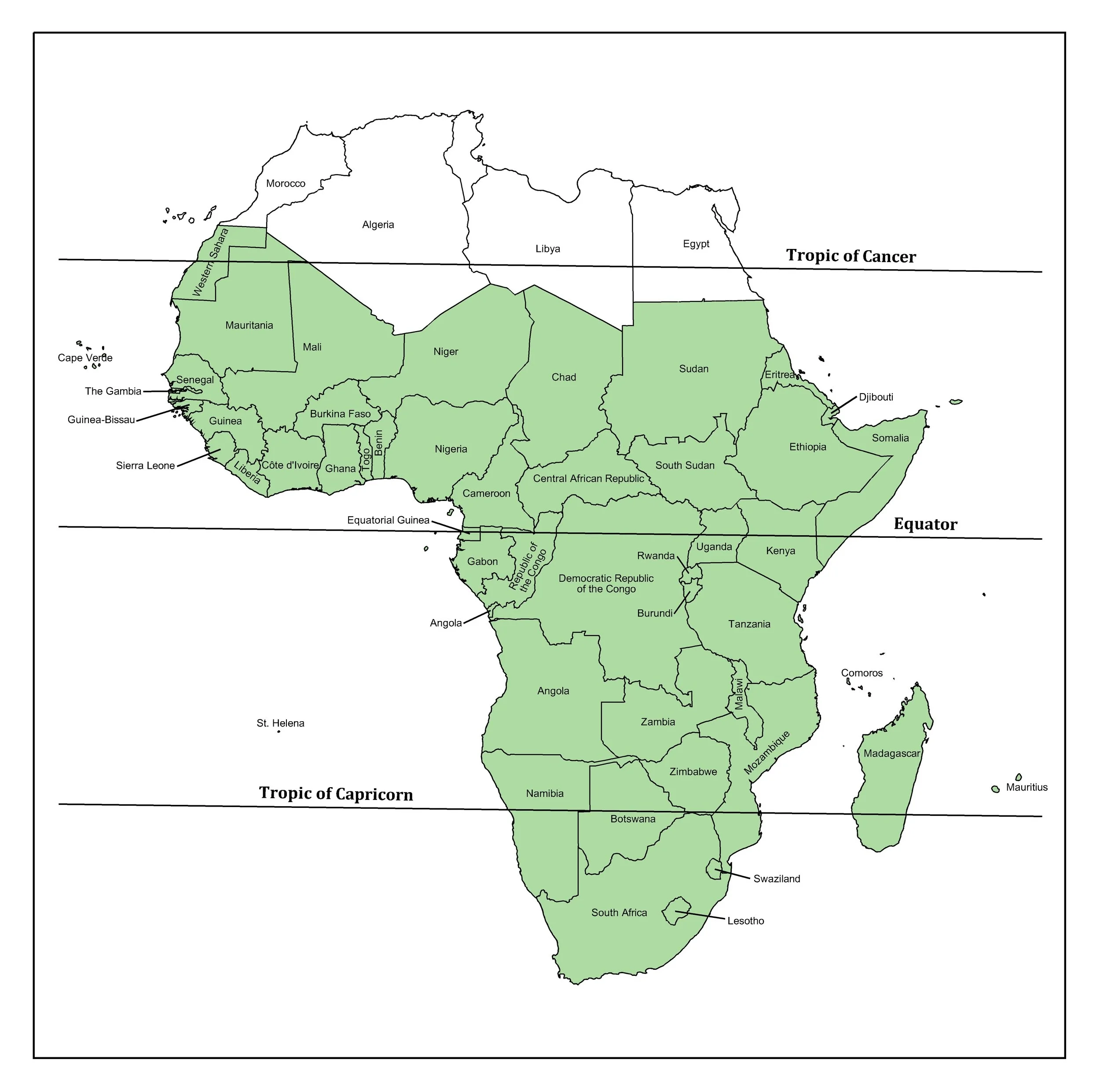
Sub-Saharan Africa (SSA) is the portion of Africa that lies south of the Sahara Desert, including the Sahel region. It comprises most of the African continent and is home to the majority of Africa’s population. The African Sahel is a relatively narrow strip of land from 10 to 15 degrees north latitude extending from the far western shores of the continent to the Horn of Africa along the southern portion of the Red Sea. The total land area of the subcontinent is about 24 million km squared, which is about 18% of the total world land mass.
The equator runs through Africa at about the middle of the continent; however, the land area of the northern portion of the continent is much larger than the area of the southern half. More than 90% of the continent’s area is located between the Tropic of Cancer and the Tropic of Capricorn. SSA also includes a number of islands within both the Indian and Atlantic Oceans.
The subcontinent is made up of highlands and lowlands of varying elevations. The plateaus located in the east and south rise to about 1,000 meters above the surrounding land. The highlands and lowlands are separated by a line that extends south from the Nile Valley to the Upper Congo Basin. The lowland plains are located north of this line and range in elevation from 150 to 600 meters. Shallow depressions form inland drainage basins on some areas of the plateaus, while some of the plateaus are drained by streams formed by erosion processes causing major falls and canyons before the rivers flow into coastal plains.
The majority of the land area of SSA is drained by Lake Chad and nine major river basins, some of which are characterized by permanent and seasonal swamps. The mighty Nile’s flows largely originate in the highlands of Ethiopia. The Nile is the longest river in the world. It extends from SSA to North Africa and drains into the Mediterranean Sea.
The major mountains of SSA include Mount Kilimanjaro, the Ruwenzori Range, Ras Dashan, Elgon, the Tibesti massifs, the highlands of the Cameroonian Ranges, the Guinean Highlands, and the mountain peaks on the eastern side of Lesotho.
As for vegetation zones, SSA includes large swaths of land characterized by a semiarid climate, also called steppe. The steppe region is dominated mostly by ferruginous soils (zonal soils developed in tropical savanna or bushlands) with natural vegetation of thorny acacia and local grasses. South of the steppe lands of the Sahel is the savanna, which is a wetter region that is more biologically productive. Savanna lands are relatively easy to cultivate, with extended dry and wet seasons and significant wet-season rainfall. Another major area of SSA is rainforest, which generally receives rainfall in excess of the water demands of the forest vegetation. The other important vegetation zones in SSA are the highland grasses and mountain forests that occupy volcanic soils primarily above 1,500 meters in elevation. A large portion of the Sahel region is desert, and the Kalahari Desert is another dominant feature in the region.